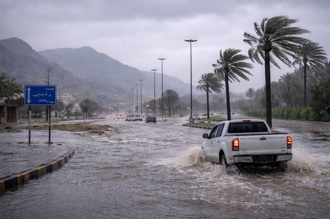

MUSCAT : Northern Oman is likely to receive above-average rainfall in October and November, while temperatures across the country are expected to remain higher than usual through December, according to a seasonal outlook issued by the Civil Aviation Authority.
The report, prepared by the National Multi-Hazard Early Warning Centre and covering September 2026 to May 2027, said global climate indicators pointed to El Niño strengthening in the coming months and reaching its peak in November and December.
The climate pattern could influence rainfall and temperatures and increase the risk of some extreme weather events globally, the report said, according to the Oman News Agency.
Read More
- Omani Women’s Day shines spotlight on leadership and innovation in Washington
- Honourable Lady praises Omani women’s role, welcomes additional Shura Council seats
- Oman, 18 other countries condemn Colombia’s Jerusalem embassy opening
- Oman’s agriculture and fisheries output rises 3.3% to RO 623.5 million in first half
- Oman warns of hazardous floating containers after ship sinks off Musandam
Rainfall in December is expected to be close to the seasonal average across most of Oman, although northern areas could continue to record above-average levels. Coastal areas overlooking the Arabian Sea are likely to receive below-average rainfall in October.
Temperatures are forecast to exceed their usual seasonal averages across Oman in October, November and December.
The centre said the outlook reflected the interaction of several regional and global climate patterns, rather than the effects of El Niño alone.
An analysis of climate records from 1980 to 2025 found that El Niño periods were associated with rainfall in Oman averaging 20% above normal from September to November, 31% above normal from December to February and 54% above normal from March to May.
The relationship was more pronounced in northern Oman, where moisture flows influence rainfall associated with winter weather troughs approaching from the west.
The centre stressed that those percentages described historical patterns and did not represent confirmed rainfall increases for the coming season. They could, however, help inform seasonal forecasts when assessed alongside other climate indicators.
The report warned that rainfall could cause wadis to flow and water to accumulate in some locations, alongside strong winds, rough seas and hail. It urged caution in affected areas.
Historical analysis also indicated that tropical systems could still form in the Arabian Sea between October and December, with their activity varying according to prevailing climate conditions.
The report cited the El Niño episodes of 1997–1998 and 2015–2016 as historical examples of periods during which Oman experienced significant rainfall.
In March 1997, successive spells of heavy rain and thunderstorms brought total rainfall of about 86.0 millimetres in the climate record cited by the report, compared with a long-term average of 14.8 mm.
Between March 7 and 11, 2016, Oman was affected by the Al Hamayil low-pressure system, associated with a deep atmospheric trough. Moderate to heavy thunderstorms across northern governorates caused wadis to overflow and flooding in several locations.
Al Mudhaibi recorded the highest rainfall during that event at 120.4 mm, followed by Rustaq at 105.2 mm and Bahla at 101 mm. The rainfall also replenished water resources, raising dam levels and groundwater reserves in affected areas.
The centre said it would continue monitoring El Niño and related climate patterns, assessing their potential effects on Oman in coordination with agencies involved in the national emergency management system.
El Niño is a naturally occurring climate pattern involving interactions between the ocean and atmosphere in the tropical Pacific. It is associated with warmer-than-average sea-surface temperatures and shifts in winds and atmospheric pressure, with effects that vary across regions.
For all the latest news from Oman and GCC, follow us on Twitter, Instagram and LinkedIn, like us on Facebook and subscribe to our YouTube page, which is updated daily.





