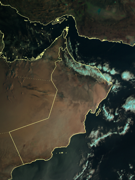

MUSCAT – Cloud advection is expected over the northern governorates, with chances of isolated rainfall over Muscat, North Al Batinah, South Al Batinah, and the Al Hajar Mountains. There is also a possibility of low clouds forming late at night and early morning over parts of Al Dakhiliyah, South Al Sharqiyah, Al Dhahirah, Al Wusta, and Dhofar governorates.
Met office has reported the continued flow of cloud formations across parts of the Sultanate, with opportunities for scattered rainfall over areas overlooking the Sea of Oman, the Arabian Sea, and parts of the Hajar Mountains.
Analysis of the latest satellite imagery indicates the presence of stratiform cloud cover accompanied by scattered showers in some regions. Cumulonimbus cloud development is also expected, which may bring varying amounts of rainfall, active downdrafts, and, during thunderstorm activity, hail and lightning. In some areas, deeper cumulonimbus clouds could result in more intense and widespread weather conditions, including moderate to heavy rainfall, strong downdrafts, hail of varying sizes, and significant lightning.
Read More
- Indian expat airlifted to hospital after road accident in Oman
- Truck carrying steel coils triggered deadly 15-vehicle Samail crash: Royal Oman Police
- Global experts to gather in Oman to combat water and climate challenges
- Oman orders investigation into horrific Samail crash that killed six
- Over 220 Raqaq bread packs seized in Oman over alleged expiry date manipulation
Authorities urge the public to remain alert, as fog formation may lead to reduced horizontal visibility in affected areas.





