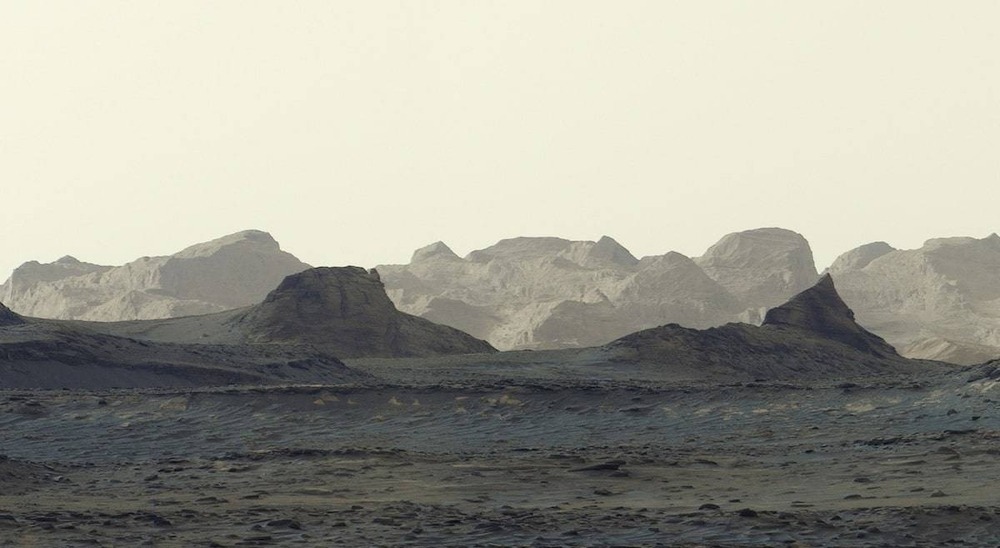

WASHINGTON : The image, released by NASA this week, was captured by Curiosity’s Mastcam on August 11 at about an hour after the sun rose over an area that includes rocky slopes sculpted by wind and weather over long periods of time.
The panorama combines six individual images that were stitched together after being sent back to Earth. Unlike most of Curiosity’s Mastcam images, this one was processed without the usual white balancing, an artistic choice that preserves the early morning appearance.
The sunlight highlights jagged formations known as yardangs on the horizon. The features form part of a geological layer extending about 16 kilometres across the northwestern reaches of Mount Sharp, the 5-kilometre-high mountain that Curiosity has been climbing since 2014.
Ashwin Vasavada, Curiosity project scientist at NASA’s Jet Propulsion Laboratory, said the yardang layer appears unusual compared with the surrounding layers of Mount Sharp. Scientists are still working to determine how it formed, with one possibility being that it consists of volcanic ash deposited on Mars in the distant past.
The yardang layer is thought to have formed about 3 billion years ago. NASA said the material may have been deposited after earlier layers of Mount Sharp had eroded, creating a gap in the mountain’s geological record before new material accumulated.
For all the latest news from Oman and GCC, follow us on Twitter, Instagram and LinkedIn, like us on Facebook and subscribe to our YouTube page, which is updated daily.
Read More
- Broken-down truck disrupts Muscat Expressway traffic towards Seeb
- Dhofar Municipality gives 14-day deadline to remove illegal animal pens in Salalah
- SalamAir records 76% On-Time Performance in Q3 2026 as passenger numbers jump 51%
- Oman arrests seven over electricity station thefts that caused power outages
- Al Mudhaibi Health Center in Oman to close permanently as services move to new complex





