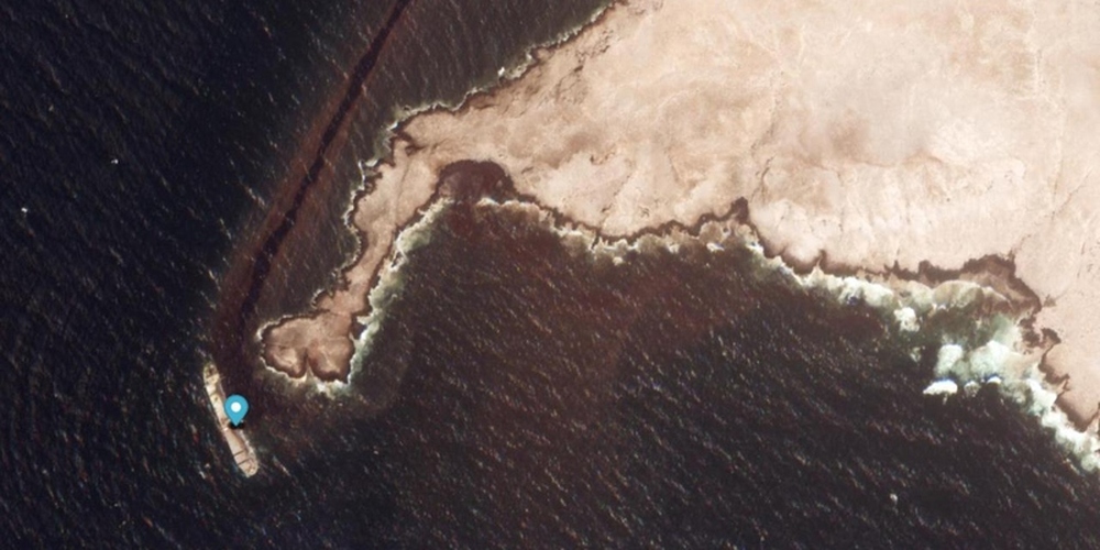

MUSCAT: The slick was detected at its closest point approximately 7 kilometres from the coast, while satellite imagery and monitoring showed that its observed extension along its path had reached about 449 kilometres, according to the Environment Authority.
The Environment Authority and the Ministry of Transport, Communications and Information Technology are coordinating with other national authorities to address the incident through an integrated response covering leak containment, securing the vessel, environmental monitoring and assessment, and measures to protect marine ecosystems and navigation.
The Environment Authority said its latest monitoring and technical analysis confirmed the continued presence of oil pollution on the sea surface. The slick is continuing to move, change shape and spread under prevailing marine and atmospheric conditions.
Read More
- Oman birth rate falls nearly 39% in a decade, forum urges support for families
- Oman Chamber of Commerce and Industry elections set for November 23
- What did His Majesty Sultan Haitham and UAE’s Sheikh Tahnoun discuss during Muscat meeting?
- Oman Investment Authority invests in Spanish space company PLD Space
- Oman health facilities rise to 2,464 as sector expands in 2025
According to current environmental modelling, the slick is generally moving north-east and is expected to advance by about 121 kilometres over the next 48 hours, depending on prevailing winds, currents and other marine and atmospheric conditions.
The authority stressed that the 121-kilometre projection is a scientific prediction rather than an observed movement, and could change as weather and sea conditions change.
The Environment Authority said the thickest parts of the pollution may be moving towards the entrances of Ras Madrakah, prompting continued intensive monitoring of marine and coastal areas considered environmentally sensitive or of high ecological value.
Monitoring is being carried out by specialised national technical teams using satellite imagery, environmental models, aerial surveillance and field and marine surveys. The data is analysed continuously to track changes in the size, location and direction of the slick and assess potential risks to marine and coastal environments.
The authority said the reported 390 square-kilometre area does not represent the volume of oil spilled. Rather, it refers to the geographical area in which pollution was detected during the latest monitoring and analysis.
It said the relationship between the area of an oil slick and the volume of spilled oil cannot be established directly because it depends on factors including the thickness and nature of the oil layer, dispersion, sea currents, wind direction and speed, waves and other marine conditions.
The size, shape and location of the slick may therefore change between monitoring exercises as the oil moves, spreads and undergoes natural dispersion. The reported area should consequently be regarded as a technical reading associated with the time of monitoring, rather than a fixed figure.
The authority is also comparing successive monitoring results to determine the rate and direction of the pollution’s movement and to establish whether observed slicks represent continuing accumulations or scattered areas resulting from dispersion and spreading.
His Excellency Dr Abdullah bin Ali Al Amri, Chairman of the Environment Authority, said environmental monitoring and assessment results showed that there was currently no cause for concern regarding vital facilities, including water desalination plants, the fish farming project and economic and tourism facilities along the coast.
He said seawater was being continuously examined by specialised technical teams from the Environment Authority.
His Excellency said there were no oil slicks or impacts threatening public safety, adding that emergency plans had been activated to address various possible scenarios and protect against potential impacts.
He also noted that aircraft were tracking oil slicks and monitoring their movement daily in designated areas.
According to His Excellency Dr Abdullah bin Ali Al Amri, difficult weather conditions had made technical operations more challenging but had also helped reduce the direct environmental impact by pushing oil slicks away from Omani shores.
The authority said the protection of biodiversity, marine habitats and environmentally sensitive areas remained a priority. Risk assessments are being updated continuously according to changes in the location, size and direction of the pollution.
The assessment covers sensitive areas, islands and marine habitats, including coral reefs, turtle nesting sites, marine ecosystems and environmentally important coastal areas.
The authority also urged the public and media to rely on official updates and avoid circulating unapproved figures, maps or estimates.
It stressed the need to distinguish between information that has been directly observed and data generated through forecasts and modelling. Estimates concerning the volume of oil spilled should not be treated as final or officially approved unless they are based on a documented technical assessment by the competent authorities.
Meanwhile, the Ministry of Transport, Communications and Information Technology said technical work was continuing with specialised teams from national authorities and an appointed specialist company to inspect the condition of the vessel and assess damage to its hull.
The work aims to identify the sources of leakage and develop appropriate technical solutions to prevent further deterioration of the vessel and address the leaks. This includes the safe transfer of its oil cargo before the vessel’s hull is salvaged, while maintaining maritime safety requirements.
Mohammed bin Abdullah Al Rawahi, Director General of Maritime Affairs at the Ministry of Transport, Communications and Information Technology, said difficult climatic conditions during the autumn season had made technical operations to address the leak more challenging.
He said ministry teams, personnel from other relevant national authorities and specialists from the appointed company were intensifying efforts to identify the sources of the leak, preserve the integrity of the ship’s hull and address leaks inside the vessel.
The operations include aerial surveillance, marine diving, continuous field monitoring and the development of technical solutions to safely transfer the vessel’s oil cargo.
The immediate priority, Al Rawahi said, is to reduce continued pollution and address its sources, secure the vessel and transfer its oil cargo as safely as possible, while protecting response teams, the marine environment and navigation in the area.
He said the response also involved coordinating air, maritime and logistical support to enable technical teams and equipment to reach the vessel.
The ministry is working closely with the Environment Authority, using satellite monitoring, aerial surveys and marine and field inspections to establish operational priorities and assess risks associated with the incident.
Technical teams from the relevant authorities are working around the clock, using satellite imagery and time-series comparisons to monitor the movement of pollution, alongside aerial surveys of priority marine and coastal areas.
Marine and field inspections are being conducted to verify conditions on the sea surface and along the coast, while environmental modelling is being used to forecast the potential direction and spread of pollution.
The modelling incorporates data on winds, sea currents and waves and links pollution data with maps identifying environmentally sensitive areas.
The authorities said the different monitoring tools are being used together to provide an updated assessment of the environmental situation, with model predictions compared against changes observed through field and satellite monitoring.
The Environment Authority is responsible for managing and coordinating the environmental response under the National Oil Pollution Control Plan, in coordination with relevant national authorities.
These include the Ministry of Transport, Communications and Information Technology, the Royal Air Force of Oman, the Royal Oman Police – Coast Guard, the Royal Navy of Oman, the Maritime Security Center, the National Emergency Management Center, the Ministry of Agriculture, Fisheries and Water Resources, the Ministry of Interior – Municipal Sector, the Ministry of Economy, and the Ministry of Finance, with each entity operating within its respective jurisdiction.





