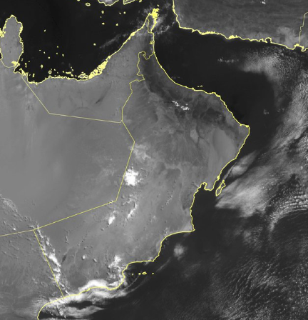

MUSCAT – As per the latest forecast, cumulus clouds have begun forming over the Hajar Mountains, with chances of scattered showers that may become thundery at times and be accompanied by strong downdraft winds. Similar cloud activity is expected over parts of the desert areas of Dhofar Governorate, while intermittent drizzle is forecast to continue along the governorate’s coastal strip.
Oman Meteorology issued a moderate thunderstorm warning for parts of the Hajar Mountains and surrounding areas beginning at 12: pm on June 25. A separate moderate warning for downdraft winds in the same areas came into effect at 11 am.
In southern Oman, a limited thunderstorm alert has been issued for Dhofar mountains and neighbouring areas starting from 11 am, while limited rainfall is expected along parts of the Dhofar coastline from 10 am.
Read More
- Oman extends condolences to Pakistan after Islamabad hospital fire
- GCC history forum participants thank His Majesty Sultan Haitham for Oman’s warm hospitality
- His Majesty Sultan Haitham sends condolences to Nepal president over flood, landslide victims
- Oman records highest temperature of 46.2°C
- Heavy rain and hail lash Oman’s Al Buraimi, triggering wadi flows
Meteorologists have also warned of moderate active winds affecting several coastal and desert regions, including Al Jazir, Duqm, Jalan Bani Bu Ali, Sadah, Shalim and the Hallaniyat Islands, Taqah, Mahout, Mirbat and Masirah from 10 am.





