
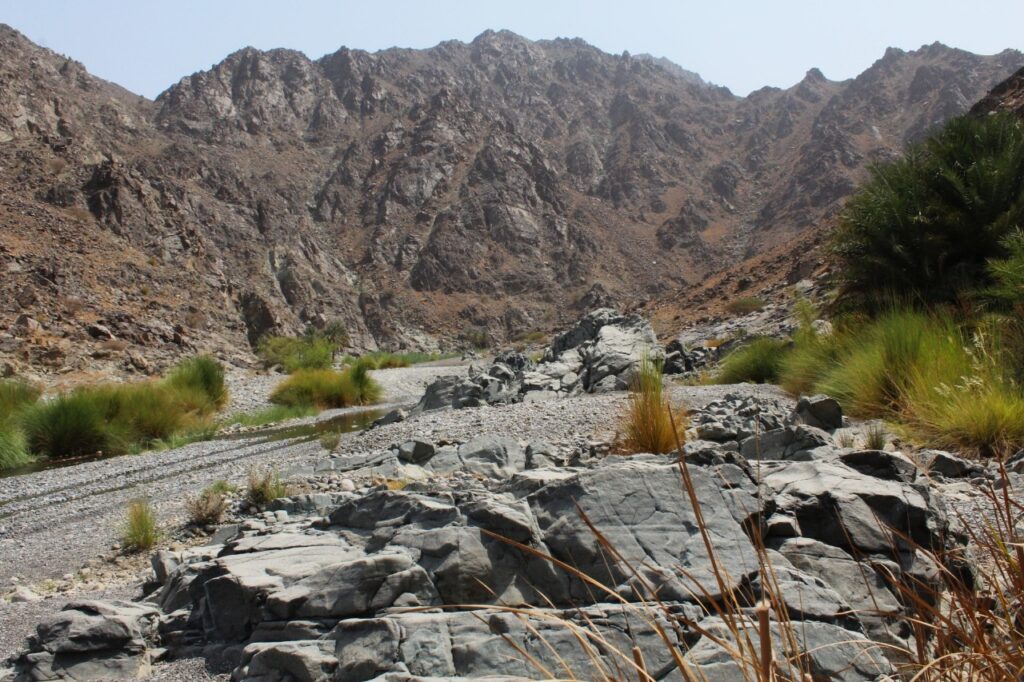
MUSCAT – Known for its serene beauty, the wadi features natural pools and camping areas along its path – many of which offer tranquillity and privacy thanks to their distance from residential zones and main roads.
Stretching from the Western Hajar Mountains to the Sea of Oman, Wadi Al Abyad is part of an extensive watercourse that flows through numerous villages and agricultural oases situated between the mountains and the coast.
Read More
- An emotional homecoming: Thousands greet Kerala CM Pinarayi Vijayan in Muscat
- Oman unveils ‘Meteorite Corner’ in Duqm, showcasing the Sultanate’s celestial heritage
- CAA confirms tropical depression over Arabian Sea, Oman to not be affected
- Salalah Airport welcomed first direct flight from Belarusian airline Belavia, boosting connectivity between Oman and Eastern Europe
- His Majesty the Sultan extends congratulations to Kazakhstan on Republic Day
According to Dr. Al Moatasem bin Nasser Al Hilali, Director of the Department of Heritage and Tourism in South Al Batinah, the name ‘Wadi Al Abyad’ (meaning White Valley) is derived from the white rock formations that dominate the landscape, a feature documented in several historical references.
The valley passes through a number of traditional villages, including Al Hillah Al Aliyah, Hillat Al Muataridh, Al Khatm, Al Haseen, Al Mukhtabiyah, Al Saliyah, Qalqal, Wadi Abu Dhahabah, Al Rawdah, Al Saih, Al Jazirah, Al Katheeb, Katheeb Al Ras, Al Ghubaira, Al Muhaidith, Al Shua’iyah, and Al Sa’adah, among others. These settlements reflect the valley’s deep agricultural and residential roots.
Reaching the more remote camping sites deep within the valley requires a four-wheel-drive vehicle, as visitors must navigate water crossings and rocky terrain. For many, this challenging journey is part of the appeal; an opportunity for adventure and exploration in one of Oman’s most scenic valleys.
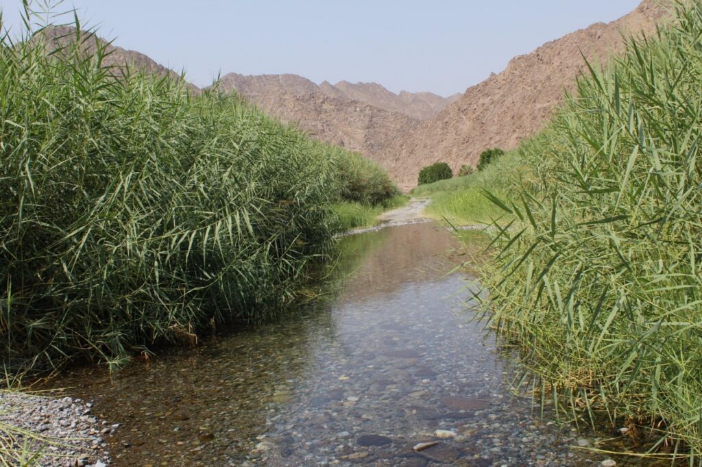
Wadi Al Abyad hosts a diverse vegetation cover, split between cultivated crops and native wild flora. Local farms grow palm trees, citrus fruits, seasonal produce, and other fruit trees, while the surrounding hills and wadis are home to some wild plants.
Agricultural irrigation in the valley continues to rely on traditional falaj systems, using an age-old method that calculates irrigation times based on the movement of shadows using sunlight, moonlight, and starlight. Among the most notable aflaj in Wadi Al Abyad are Falaj Al Abtari, Falaj Al Khatm, Falaj Al Shaghi, Falaj Al Hussain, and Falaj Al Sidr.
The wadi also features a number of historical and archaeological landmarks, including Beit Al Oud, Al Khatm Tower, Al Marfa Tower, and Al Saliyah Tower, which reflect the region’s rich cultural past.
From a geological perspective, Wadi Al Abyad is of special interest. It contains evidence of the Mohorovičić discontinuity (Moho – the boundary between the Earth’s crust and mantle—making it a valuable site for researchers and geologists worldwide. Few places offer such a clear surface view of this deep-earth structure.
Wadi Al Abyad is easily accessible as it is approximately 28 km from the Sultan Qaboos Highway, 14 km from the Al Batinah Expressway, and 22 km from the Barka-Nakhal Road.
Despite reduced rainfall in recent months, water still flows year-round in deeper sections of the valley. This sustained water availability has helped preserve the lush environment, contributing to the site’s appeal as a sustainable and year-round tourism destination.


")

