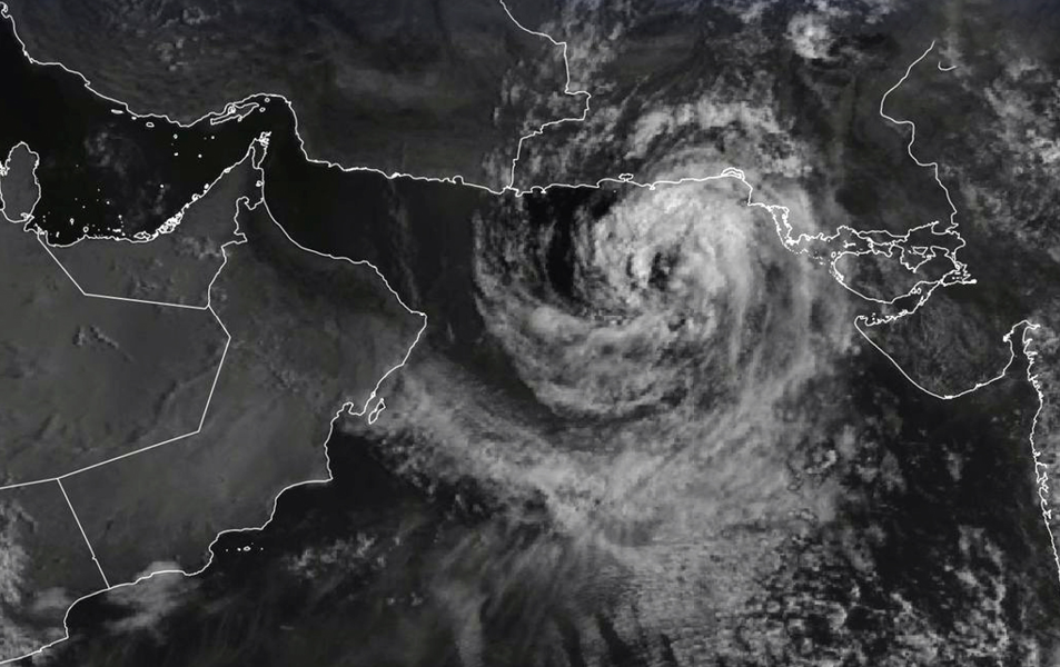

Muscat: As of the latest reports, the centre of the storm is positioned approximately 635 kilometres from the Sultanate’s coast.
With wind speeds ranging between 34 to 45 knots, the storm slowly drifts westward towards the Sea of Oman.
The closest rainy clouds are now just 280 kilometres away from the Omani coastline, signalling a potential shift in weather patterns.
Read More
- Heavy rain and hail lash Oman’s Al Buraimi, triggering wadi flows
- Honourable Lady visits Omani Women’s Association in Salalah
- Oman Foreign Minister holds talks with Tunisia, Brunei on bilateral ties and global developments
- Oman, Kazakhstan review bilateral ties and regional developments
- Oman’s Health Ministry urges public to act on suspected unsafe food
Located at 23.3°N 65°E, the system’s intensification remains low, according to experts.
The system is expected to continue its westward trajectory over the next 24 hours before gradually shifting south-southwest, with a gradual dissipation anticipated by Tuesday, September 3rd, away from South Al Sharqiyah’s coast.
Starting Sunday evening through Monday, the storm could bring varying intensity rain (10-30 mm) to the governorates of South Sharqiyah, North Sharqiyah, Muscat, and parts of Al Wusta. These conditions may trigger wadi flow in affected areas. Additionally, rainfall between 30 to 100 mm is expected alongside fresh winds ranging from 15 to 30 knots (28-55 km/h) and rough seas with wave heights between 3 to 5 meters. The CAA warns of possible seawater inundation in low-lying coastal areas.
The Civil Aviation Authority advises residents and mariners to take necessary precautions, particularly during periods of rainfall and potential flash floods.





